
Via Ardèche: from Lalevade d'Ardèche to Gagnieres
Lalevade-d'Ardèche > Gagnières
© ©A.Renaud-Goud-ADT07

© ©ARG-ADT07

© ©On-visite.com-ADT07-COPIE INTERDITE

© ©A.Renaud-Goud-ADT07

© ©ARG-ADT07

© ©H.Hellmann-Shutterstock-ADT07

100 Allée de Vals
07380 Lalevade-d'Ardèche
Departure altitude: 267 m
240 Rue de l'Industrie
30160 Gagnières
Arrival altitude: 194 m
At present, 61km of the “voie douce” can be used.
Along the way, on 51km you can get away from it all and discover Vinezac, Vogüé, Balazuc and Labeaume, four villages with the Villages de Caractère label.
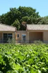
Cycling and vineyards: No fewer than 6 vineyards and tasting cellars with the Vignobles et Découvertes label, ideal for developing ideas for cycling and wine tours, line the route along the Jalès plain.
To the south, at the Saint-Paul-le-Jeune tunnel exit, there is a 3km connection to Gagnières.
From Saint-Sernin a second section of 13km allows to join Largentière.
From Vogüé a third section of 27km allows to join Le Teil while waiting to connect ViaRhôna in Rochemaure.
Your contact
Agence Développement Touristique de l'ArdèchePôle Bésignoles, 6 Rte des Mines, 07000 Privas
07000 Privas
On the itinerary


Positive elevation (ascent): 440 m
Negative elevation (descent): 506 m
Route development
27% shared roads
72% cycle paths
69% greenways
Road surfaces
33.1 km on asphalt or tarred road
10.1 km on unknown surface in the Open Street Map database
25.1 km on rolling path (compacted sand, gravel, cobblestones)
206 m on trail and off-road track
Find this route on the Loopi mobile app
Scan the QR code, save it as a favorite, or start the guidance, just enjoy!


Scan the QR code, save it as a favorite, or start the guidance, just enjoy!
This route is provided by: Agence de Développement Touristique de l'Ardèche
Be cautious and prepared during your outings. Loopi and the author of this sheet cannot be held responsible for any problems that occur on this route.