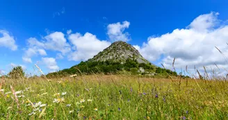
Rochebonne Castle
Le Cheylard
25 Route d'Eyrium
07160 Le CheylardDeparting from the Gare district in Le Cheylard, you'll follow the 8 km “Dolce Via”, a former railroad line that has been converted into a soft path running alongside the wild Eyrieux gorges.
After 10 km, stop off at the Atelier du Bijou for a tour of the former Murat factory in Saint-Martin-de-Valamas.
Then climb up a scenic road to the remains of the Château de Rochebonne, with its remarkable views of the Mézenc-Gerbier massif at over 980 m altitude.
At the 18th km point, take a bite to eat at Saint-Jean-Roure, before taking a small wooded road downhill for 4 km to the perched village of St-Cierge-sous-Le Cheylard.
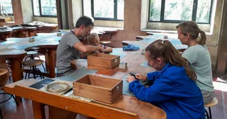
After this scenic descent, head for the historic heart of Le Cheylard to discover the scientific and fun exhibitions at the Arche des Métiers, as well as jewellery-making techniques at the Maison du Bijou.
Your contact
Agence Développement Touristique de l'ArdèchePôle Bésignoles, 6 Rte des Mines, 07000 Privas
07000 Privas
Find this route on the Loopi mobile app
Scan the QR code, save it as a favorite, or start the guidance, just enjoy!
Scan the QR code, save it as a favorite, or start the guidance, just enjoy!
On the itinerary
Route development
72% shared roads
27% cycle paths
27% cycle routes
27% greenways
Road surfaces
14.7 km on asphalt or tarred road
13.1 km on unknown surface in the Open Street Map database
3.70 km on rolling path (compacted sand, gravel, cobblestones)
This route is provided by: Agence de Développement Touristique de l'Ardèche
Be cautious and prepared during your outings. Loopi and the author of this sheet cannot be held responsible for any problems that occur on this route.


