
Karst and contrasts around Balazuc and the Ardèche
Pradons
© ©Marina Geray

© ©EW-ADT07

© ©A.Renaud-Goud-ADT07

© ©Marina Geray

© ©Marina Geray

© ©Marina Geray

335 Chemin des Blaches
07120 Pradons
Departure altitude: 136 m
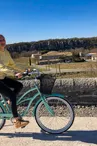
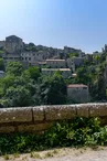
This “short” bike loop has everything you need for a wonderful (half) day of exercise, relaxation, and exploring the landscapes and heritage of the villages of Balazuc, Pradons, and Chauzon. On the itinerary: charming villages and panoramic views, a shaded greenway and engineering structures, small roads and a plateau covered in garrigue, rocky cirques and cliffs, beaches and a river for swimming.
Your contact
Agence Développement Touristique de l'ArdèchePôle Bésignoles, 6 Rte des Mines, 07000 Privas
07000 Privas
On the itinerary
Positive elevation (ascent): 265 m
Negative elevation (descent): 266 m
Show slopes on the mapSlopes measured over 500 m
Slope breakdown
Steep descent (below -5 %)510 m · 3 %
Gentle descent (-5 % to -1 %)6.63 km · 35 %
Flat (-1 % to 2 %)6.45 km · 34 %
Climb (2 % to 5 %)3.57 km · 19 %
Hard climb (5 % to 8 %)1.53 km · 8 %
Route development
Shared roads13.2 km · 70 %
Cycle paths5.51 km · 29 %
Greenways5.51 km · 29 %
Road surfaces
Asphalt or tarred road8.78 km · 46 %
Unknown surface in the Open Street Map database5.22 km · 27 %
Rolling path (compacted sand, gravel, cobblestones)4.69 km · 25 %
Trail and off-road track14 m · 0.07 %
Find this route on the Loopi mobile app
Scan the QR code, save it as a favorite, or start the guidance, just enjoy!


Scan the QR code, save it as a favorite, or start the guidance, just enjoy!
This route is provided by: Agence de Développement Touristique de l'Ardèche
Be cautious and prepared during your outings. Loopi and the author of this sheet cannot be held responsible for any problems that occur on this route.