From the Dolce Via to the Vernoux plateau
Les Ollières-sur-Eyrieux
3 Place de la Gare
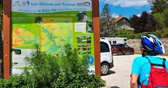
07360 Les Ollières-sur-EyrieuxStart your itinerary at the old train station in Les Ollières-sur-Eyrieux (Place de la Gare). Take the “Dolce Via” footpath through the lower Eyrieux valley to the village of Saint-Fortunat-sur-Eyrieux (approx. 6 km on a downhill slope). Here you're on a former railroad line built in 1886, operated until November 1968, then unshod, and rehabilitated as a “soft” route in 2001.
From Saint-Fortunat-sur-Eyrieux, take the D120 to quickly reach the entrance to the village of Dunière-sur-Eyrieux. Keep right on the D231 road, which climbs gently for around 15 km through the heart of the Dunière valley, towards the Plateau de Vernoux (with lovely views of the Dunière gorges, and the remains of the Château de la Tourette, which dates back to the 13th century).
In Vernoux-en-Vivarais, you can take a refreshing break on the shores of Lac aux Ramiers, before heading to the village center, where you'll find a variety of restaurants, shops and services. Take the opportunity to visit the Sacré-Coeur church, a remarkable neo-Gothic monument.
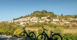
Take the D2 road to reach the village of Silhac via the Pont du Belay. Continue along the D2 and then the D241 to reach the charming medieval village of Chalencon (awarded the “Village de caractère d'Ardèche” label in 2005, and the “Petite Cité de caractère” label in 2018). Take time to explore the old village on foot, with its picturesque streets steeped in history, not forgetting the Porte de Besse (ancient 12th-century village gate) and the Place du Valla (panoramic view of the Eyrieux valley and Ardèche mountains, orientation table).
Then take the D364 road, which runs for around 7.5 km downhill to the old Chalencon railway station in the hamlet of Pont-de-Chervil. This road offers lovely panoramic views over the Eyrieux Valley and the Monts d'Ardèche.
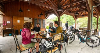
As you enter Pont-de-Chervil, continue along one of the most beautiful stretches of the “Dolce Via”, returning to Les Ollières-sur-Eyrieux (approx. 14 km downhill). At the end of your hike, you can enjoy a refreshing stop-off in the Vallée de l'Eyrieux: several good addresses are within easy reach.
Tip:
To make the most of this itinerary, we advise you to set off before 10am.
Your contact
Agence Développement Touristique de l'ArdèchePôle Bésignoles, 6 Rte des Mines, 07000 Privas
07000 Privas
Find this route on the Loopi mobile app
Scan the QR code, save it as a favorite, or start the guidance, just enjoy!
Scan the QR code, save it as a favorite, or start the guidance, just enjoy!
On the itinerary
Route development
61% shared roads
38% cycle paths
38% cycle routes
38% greenways
Road surfaces
14.7 km on asphalt or tarred road
28.4 km on unknown surface in the Open Street Map database
9.70 km on rolling path (compacted sand, gravel, cobblestones)
1.65 km on trail and off-road track
This route is provided by: Agence de Développement Touristique de l'Ardèche
Be cautious and prepared during your outings. Loopi and the author of this sheet cannot be held responsible for any problems that occur on this route.

