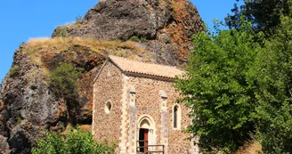
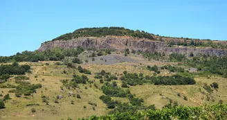
Hiking : strombolian volcanos
Saint-Pons
4 Place du Plot
07580 Saint-PonsPage number 5 of the "Monts de Berg & Massif du Coiron" hiking guidebook
Free download on the website of our tourism office
Or sold in paper version with its map for 7€
From the door of the trekking information point in St Pons, take the road that goes up to the left of the information board, then turn right and then left onto a path that goes up into chestnut trees.
At the 1st gate continue up along the basalt cliff to the junction at
LA PLAINE DU REGARD
DIRECTION: BERZEME
Then cross the pastures towards Berzème, crossing the junction at
BRASSE NEGRE
DIRECTION: BERZEME
Follow a little road beside the fields up to the crossroads at
FAUGERES
DIRECTION: ST PONS
You will then enter a typical Coiron pasture in which you will stay well over to the left following the markings.
Then take a path that goes quite steeply down to La Roche Chérie. From this point, go back down the road to
LA PEYRE
DIRECTION: ST PONS
From there, climb up through the middle of a field, where you will then continue along beside the fence and then turn right onto a path that will take you back to the village.
Variant: at La Peyre, climb up to the left on a path on basalt flow deposits.
Once on the plateau, turn right along the fences to cross the Plaine du Regard, with a magnificent view point!
You will then come back to the Plaine du Regard pillar, which indicates the descent back to St Pons.
Special difficulties
Niveau facile
Your contact
Agence Développement Touristique de l'ArdèchePôle Bésignoles, 6 Rte des Mines, 07000 Privas
07000 Privas
Find this route on the Loopi mobile app
Scan the QR code, save it as a favorite, or start the guidance, just enjoy!
Scan the QR code, save it as a favorite, or start the guidance, just enjoy!
On the itinerary
Road surfaces
97 m on asphalt or tarred road
9.21 km on unknown surface in the Open Street Map database
582 m on rolling path (compacted sand, gravel, cobblestones)
1.19 km on trail and off-road track
This route is provided by: Office de Tourisme Berg et Coiron
Be cautious and prepared during your outings. Loopi and the author of this sheet cannot be held responsible for any problems that occur on this route.


