Le Cévenol
La Bastide-Puylaurent > Génolhac
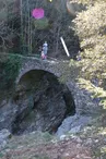
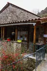
© ©on-visite.com-ADT07

© ©R.Manin-ADT07

© © A.Renaud-Goud-ADT07

© ©N.Dupieux-PNR-ADT07

© ©PNR-ADT07

Avenue de la Gare
48250 La Bastide-Puylaurent
Departure altitude: 1022 m
30 Grand Rue
30450 Génolhac
Arrival altitude: 491 m
The idea for this trail came from the existence of the "Cévennes line" railway and the local "Cévenol" train. A walk between Cévennes and Tanargue with 5 or 6 stages through pristine gorges, ideal for a swim.
Your contact
Agence Développement Touristique de l'ArdèchePôle Bésignoles, 6 Rte des Mines, 07000 Privas
07000 Privas
On the itinerary


Positive elevation (ascent): 3676 m
Negative elevation (descent): 4206 m
Road surfaces
6.45 km on asphalt or tarred road
82.1 km on unknown surface in the Open Street Map database
281 m on rolling path (compacted sand, gravel, cobblestones)
13.3 km on trail and off-road track
Find this route on the Loopi mobile app
Scan the QR code, save it as a favorite, or start the guidance, just enjoy!


Scan the QR code, save it as a favorite, or start the guidance, just enjoy!
This route is provided by: Agence de Développement Touristique de l'Ardèche
Be cautious and prepared during your outings. Loopi and the author of this sheet cannot be held responsible for any problems that occur on this route.